Loading video…
The map below is of the town of Redwick. A new supermarket is planned for the town. The map shows two possible sites (S1 and S2) for the supermarket.
Summarize the information by selecting and reporting the main features, and make comparisons where relevant.
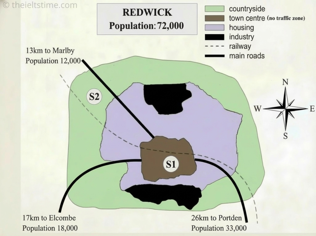
The map illustrates the layout of Redwick, a town of 72,000 residents, and highlights two potential locations, S1 and S2, for a new supermarket.
Overall, the two proposed sites differ most significantly in their location and access: S1 is located within the Town Centre, which is a traffic-free area adjacent to the main residential zone, while S2 is peripheral and situated in the countryside, close to a major road.
Site 1 is centrally located within the traffic-free town centre, placing it immediately adjacent to the main housing district. This location offers the most direct access for Redwick’s own population. Furthermore, S1 is positioned just south of the railway line, providing a transport link for customers arriving by rail from surrounding areas like Marlby and Portden. However, S1 is not situated on any main roads, meaning shoppers must walk through the built-up area to reach it.
In contrast, Site 2 is situated in the green countryside on the town’s north-western outskirts. Its key advantage is that it lies directly beside the main road connecting Redwick to Marlby. This position offers superior access by car for traffic arriving from all three satellite towns, totaling sixty-three thousand residents. However, S2 is far removed from the main housing zone of Redwick.
Leave a Reply